Real-time Geographical Data Visualization with Node.js, Socket.IO and Leaflet
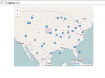
Data visualisation is becoming an increasingly important subject. As the complexity an volumes of data increase, it is getting harder and harder to make sense of bare arrays of numbers without relevant visualisation models. Let me give you a good example. Right now I work in China. Few months ago there appeared a new startup: bycicle sharing service that used GPS sensors on each bike to track it in the city. Now let's imagine, you need analyse how evenly your bikes are distributed around the city and how many of them are in motion right now.
